I’ve tracked the housing vacancy rate for homes actively on the market in the Charlottesville MSA irregularly over the past several years; it’s an indicator as to the health of the housing market. More occupied…
Browsing Category Albemarle
Charlottesville’s Getting a Hyatt. And a Residence Inn
Three new hotels coming to Charlottesville (assuming they all get approved) …
Stonefield (at the corner of Hydraulic and 29) is getting a Hyatt.
West Main and Mcintire is getting a Residence Inn.
And a Homewood Suites on Rio Road and 29.
The question is – can Charlottesville and Albemarle support three new hotels?
1st Quarter 2012 Charlottesville Area Real Estate Market Report
As always, pay attention to the segment or segments that affect you. There is no “the market is up” or “the market is down.” Condos in the City of Charlottesville near the Downtown Mall are different than single family homes in Greene County – different trends, different factors affecting them, different economic engines and hubs, different schools, different property taxes … you get the picture.
I’ll be adding to this post this evening but wanted to get this out before my afternoon appointment. (priorities, you know?)
Nest Realty’s First Quarter 2012 market report (download the pdf)
Another New Neighborhood Coming to Crozet?
Westlake Hills is proposing to build 145 new homes in Crozet. I hope they include some kind of connectivity to other neighborhoods besides roads built solely for cars. (the data show that people prefer walkability) I suppose it can be argued that developers choosing to move forward with previously-dormant neighborhood proposals is a sign of a recovering economy.
City of Charlottesville to Launch GIS Website
The City of Charlottesville will on Tuesday launch their new Geographical Information Services (GIS) website, joining Louisa, Albemarle, Nelson, Greene (which requires Internet Explorer) and Fluvanna in offering GIS to the public.
In my practice, I use GIS at least three times a week and probably recommend its use to my clients at least as many times – investigating properties’ histories, zoning, adjacent properties (but really, that’s up to the buyer) .. if Charlottesville’s GIS solution is accurate, it’s going to make neighborhood fiscal analysis‘ practical.
Until they launch it, I’ll reserve judgement other than to say, it’s about time.
Update: Here’s the City of Charlottesville’s new GIS site.
I still say, it’s about time.
Cville Bike mApp – Track your Bicycle Rides for the Next Month
People want to be close to stuff, and they want to be able to get to that stuff easily. More often, in the City of Charlottesville and more urban parts of Albemarle, “getting to that stuff” includes bicycles. Now the Charlottesville MPO is seeking to capture data that will show how many are biking to places.
Walkability matters ; so does bikeability.

For the next month or so I’m going to be using the Cville Bike mApp to track my bicycle rides around Charlottesville and Crozet instead of MapmyRide.
On April 14th the Charlottesville-Albemarle Metropolitan Planning Organization (MPO) will release the Cville Bike mApp, a free, bike route mapping application for iPhone and Android phones. The App allows cyclists to record their trips and send the trip information to the MPO for transportation planning purposes. With an expected decrease in federal transportation funding, this data will help elected officials better determine where to target limited available funds for future cycling enhancements and improvements. This data input effort will also position the region to be more competitive for transportation grant funding. More specifically, the App will allow transportation planners to map cycling patterns, determine cycling corridors, identify cycling barriers and find appropriate locations for cycling facilities.
The MPO will be collecting cycling data over an approximately one month period – from April 14th to May 18th. Help local planners and elected officials improve cycling in Charlottesville and Albemarle by recording your bike trips using the Cville Bike mApp. Remember, mApp it for Better Biking!
I have no doubt that I could find significant and substantial data to support the opposite perspective, but in my practice, I have found that my clients value bicycle and walking paths and accessibility. Can I place a quantitative value on that? No; sometimes it’s a matter of “will they buy it?” Yes or No.
The League of American Bicyclists noted in 2010:
As we pointed out in our report, The Economic Benefits of Bicycle Infrastructure Investments, studies have shown that real estate property values increase with proximity to bicycle paths. People enjoy living close to bike paths and are willing to pay more for an otherwise comparable house to be closer to one.
204 More Homes Coming to Rio Road?
Looks like I need to update my post from December pondering what Rio Road is going to look like in 5 years.
Charlottesville Tomorrow reports:
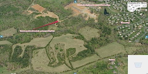
The site of a former wastewater treatment plant near Pen Park is under consideration for the construction of 204 homes in both Albemarle County and Charlottesville.
I’d agree with Planning Commissioner Green:
Commissioner Lisa Green encouraged Lopez to further interconnect Lochlyn Hills with the city.
Â
“In the city, what makes a neighborhood is [people] getting out and walking to the Downtown Mall,†Green said. “Although I applaud all the well-thought-out improvements to the trails, people want to walk to their jobs downtown and I’m not so sure they’re going to do that through the woods.â€
Not planning for or accommodating non-vehicular traffic (you know, walking and biking) is irresponsible and will, to many buyers, reduce the desirability and marketability of the homes.

