How will I show land without parcel boundaries on my phone?!
There’s been a lot of discussion about the new Apple maps, which will be replacing Google maps on the next iPhone.
This isn’t enough to switch back to an Android device from my iPhone 4S, but it’s significant. In the nearly-three-years since Google integrated Albemarle County’s property boundaries as one of its layers, I’ve become quite dependent on this extremely useful feature.
Gizmodo did a nice side-by-side comparison of Google Maps vs Apple Maps, but they left out one thing that I use in my real estate practice multiple times a week – real estate parcels.
I saw some discussion about it last week in my Twitter stream, and asked for some help on Google+
Anyone with access to iOS 6 – can you tell me if the new apple maps have parcel boundaries as the google maps do? I need and use those to show property – in subdivisions and when showing raw land.
And thankfully got an answer pretty quickly from a friend.
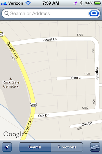
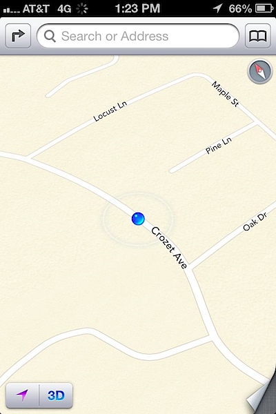
Note the difference between these two photos? iOS5 has property parcel boundaries, while iOS6 doesn’t.
While I wouldn’t advise my client to accept these boundaries in lieu of a survey, they are usually accurate enough when walking land or lots, particularly when walking county/country properties where “natural” boundaries such as power or telephone poles aren’t visible.


